Not Set
Two steel barges used to construct a slipway.
Type
Unpowered steel barge.
History
The barges were deliberately placed on the foreshore in 2005 as reinforcement for a boatyard slipway but were removed in 2021.
Description
The steel barges were largely intact; the decks still had bollards, hold coaming and tow points fitted and the holds were lined with timber dunnage on the floor and battens on the sides. These vessels were similar in style to the barge Laira Bridge 1.
Photographs courtesy of Giles Richardson.
Location and Access
The barges were in Boston's yard at Bayly's Wharf in Oreston but have now been removed.
The barges are on private land so are not accessible to the public.
Nearby hulks include Baltic Surveyor ![]() , the ferry Swift
, the ferry Swift ![]() , the dredger Plym
, the dredger Plym ![]() , barges Oreston 1 & 2
, barges Oreston 1 & 2 ![]() , and the barge Cattedown 1
, and the barge Cattedown 1 ![]() .
.
Last updated 03 Jan 2021


Information
Date Built:
Unknown
Previous Names:
Unknown
Builder:
Unknown
Official Number:
Unknown
Length
20m
Width
5.5m
Depth in Hold
Unknown
Construction
Steel
Propulsion
None
Tonnage
Unknown
Portmarks
Unknown
Outcome
Abandoned 2005
Reference
Unknown
Not Set
Leave a message
Your email address will not be published.
Click the images for a larger version
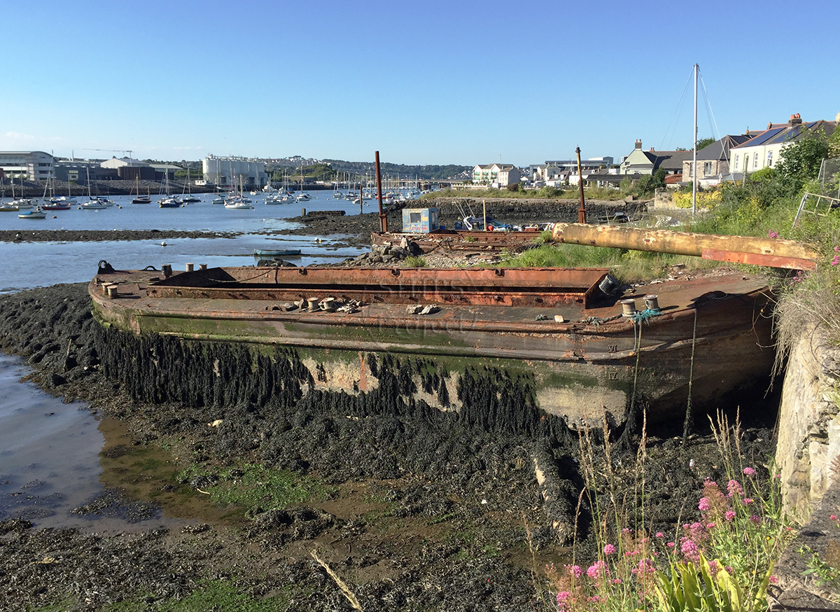
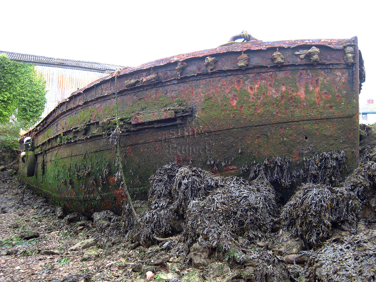
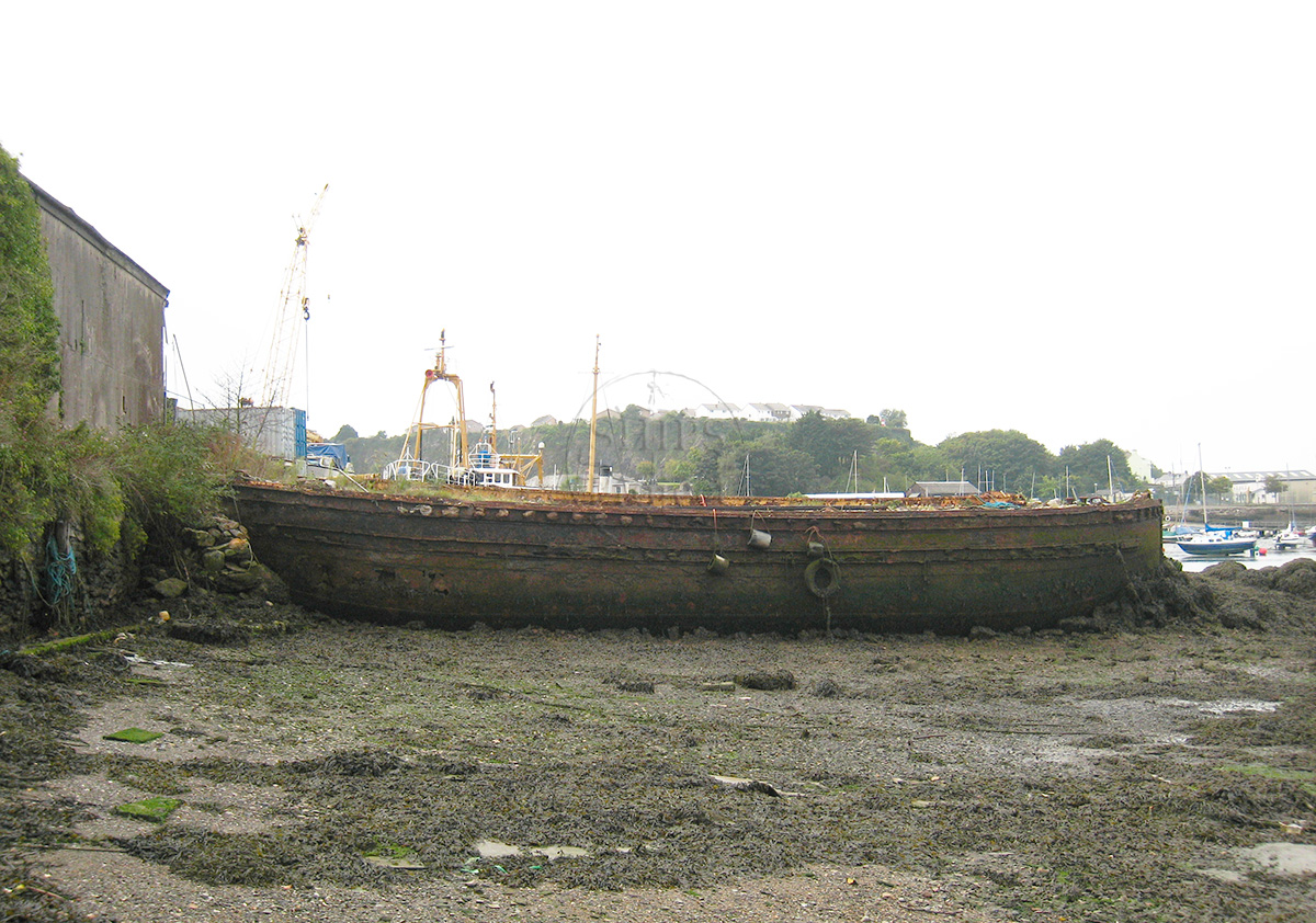
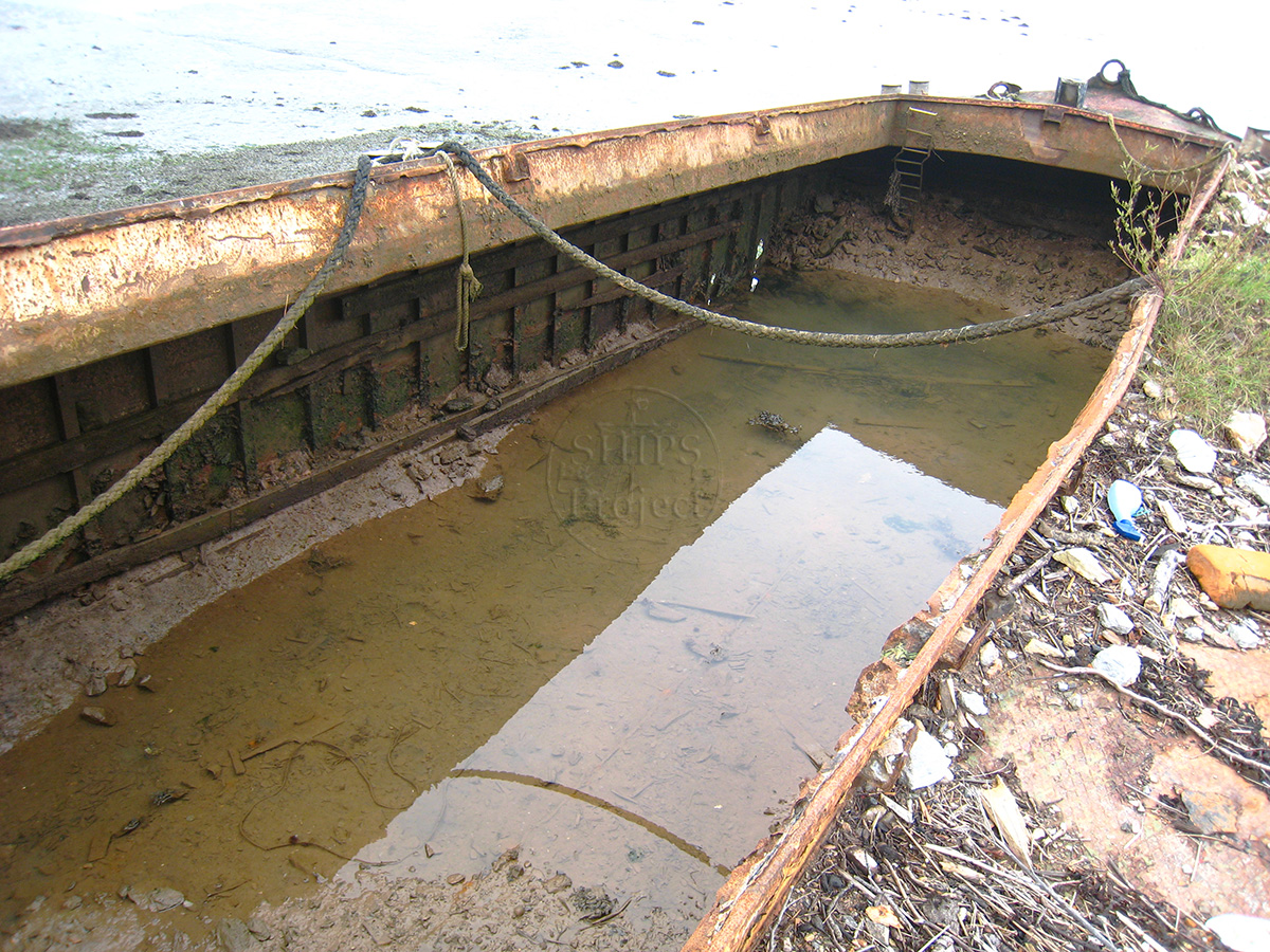
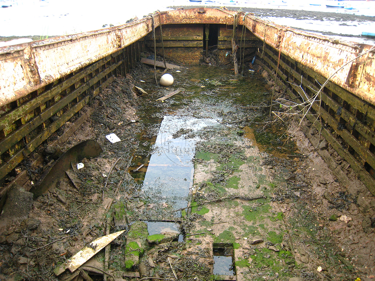
Image use policy
Our images can be used under a CC attribution non-commercial licence (unless stated otherwise).