Not Set
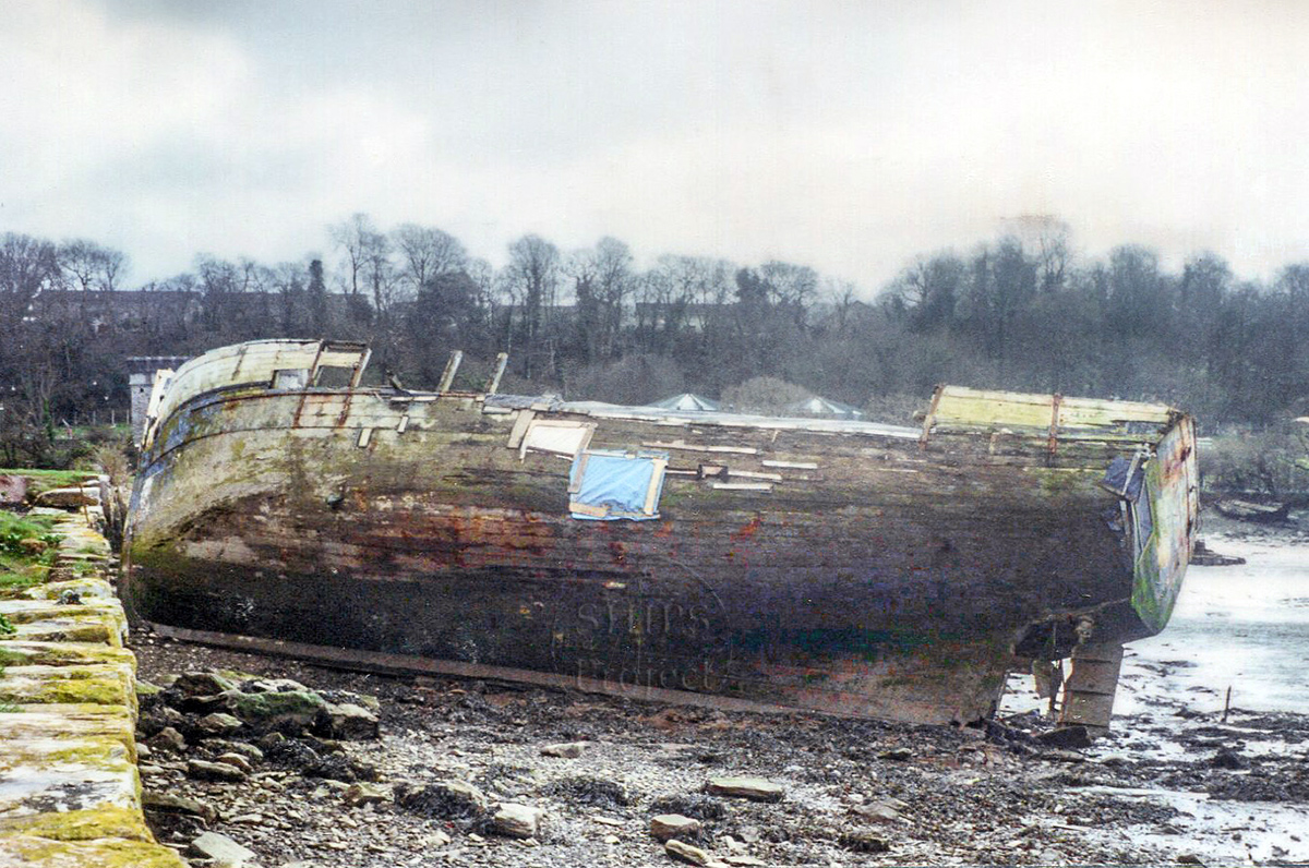
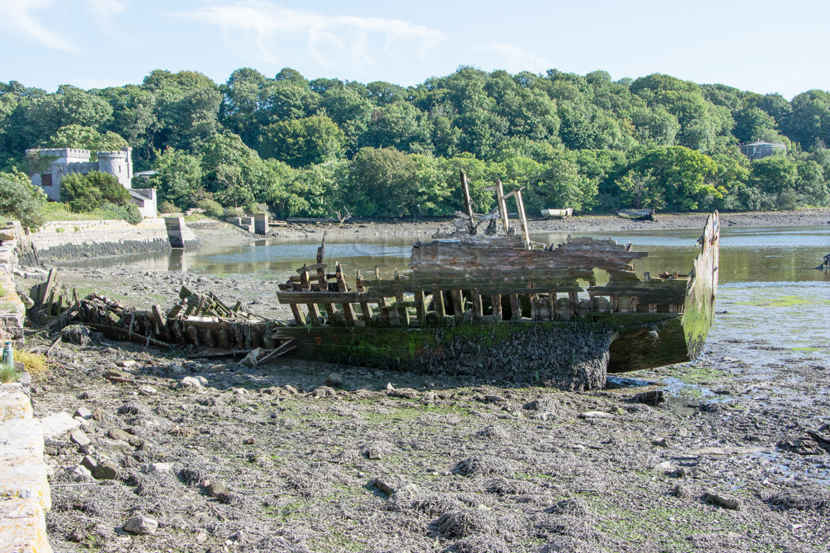
A wooden fishing boat abandoned at the far eastern end of Hooe Lake.
Types
Fishing boat
History
This timber built motor fishing vessel was floated in and abandoned around 1996, but despite it being so recent we do not know the name of this vessel and the only clue we have is that she is supposed to be French built. The faded paint scheme when the boat arrived was blue hull, white bulwarks and black lining, she has a flat transom and the unusual feature of a particularly long stem post at the bow, much higher than the bulwarks.
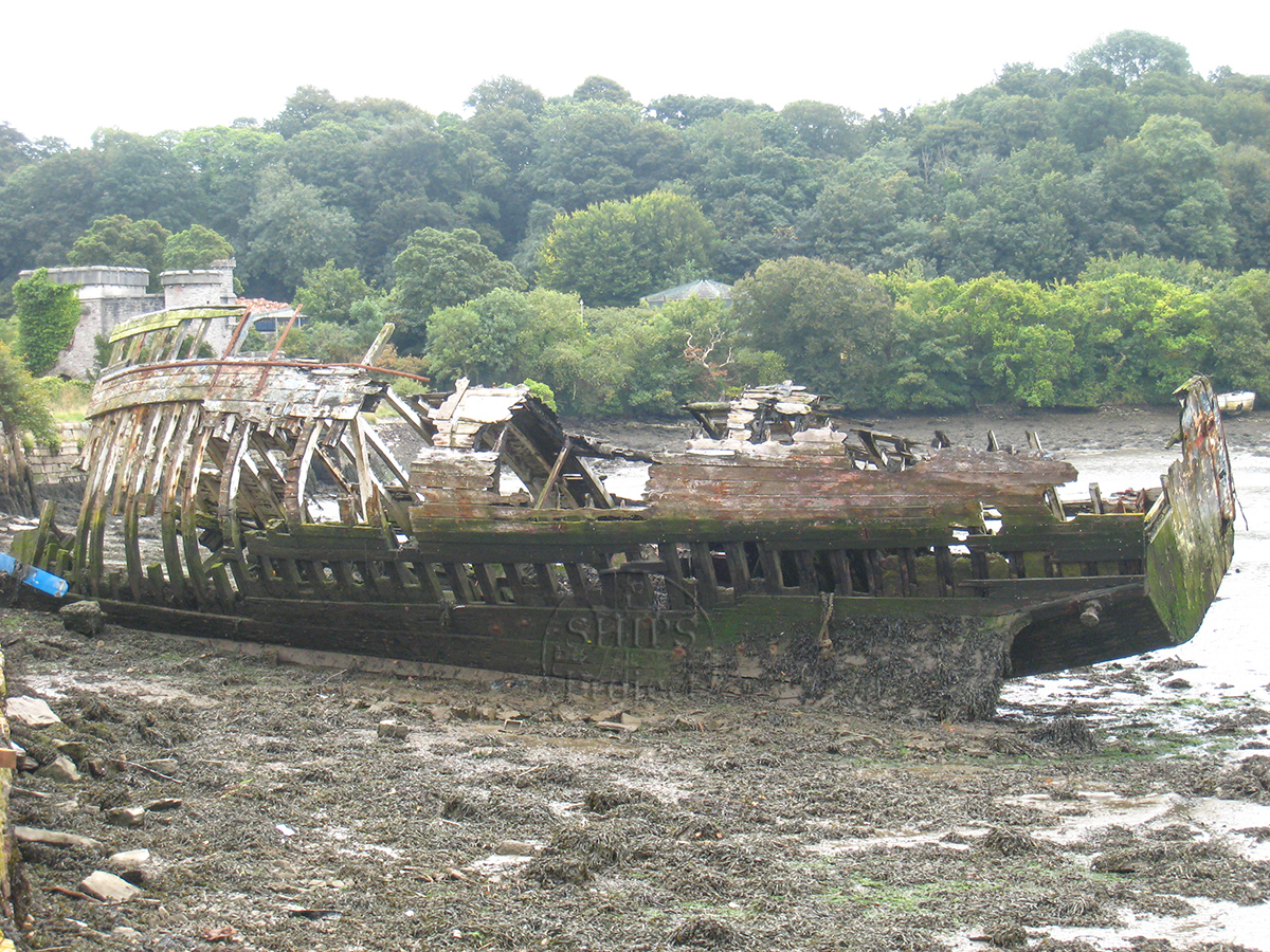
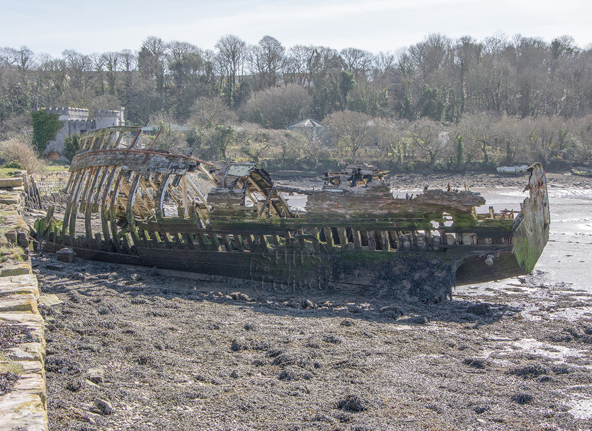
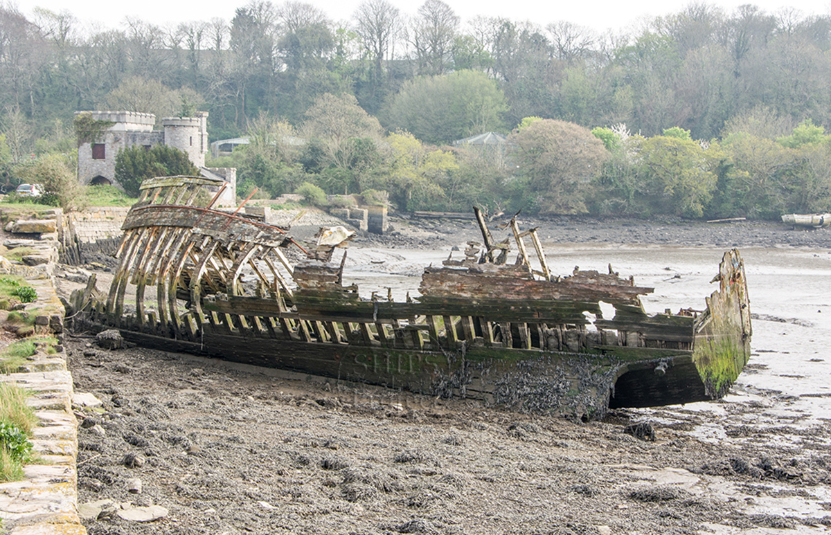
Shortly after she was beached some of her timbers were cut from her sides between her frames using a chainsaw, presumably for firewood. A fire was started inside the ship at the stern end doing significant damage to her deck aft. By 2009 the vessel was an open framework of timbers but her deck was still in place, but by 2011 this had largely collapsed. By 2020 the remaining structure was in a perilous condition so the decision was made by the landowner to pull down the deck and port side timbers.
In 2011 this vessel was used for a course on dating ship's timbers run by The SHIPS Project for the Nautical Archaeology Society.
Description
The vessel has a keel length of 15.6m so was originally ~17m long overall, built with doubled frames with each of the pair 80mm sided and 140mm moulded held together with steel bolts. The outer planking was attached with steel nails, the concrete ballast is still in place as are the large engine bed timbers and the remains of a fuel tank on the starboard side. The rudder and single propeller were attached when the vessel was abandoned but are now missing.
The slow degradation and collapse of this vessel can be seen in these photographs, all that remains now are the keel, some of the frames, a few deck beams and part of the transom.
This vessel was not mentioned in the book Lost Ships of the West Country by Langley & Small as it was abandoned after the book was published.
Location and Access
Hooe Lake, Oreston, Plymouth
From Oreston, take the Lower Saltram road off Plymstock Road then turn right into Kingfisher Way. Follow the road down to the lake and there is a car park at the end. The wreck partially covers at high tide springs so plan a visit to coincide with low water, the foreshore is accessible when the tide height is less than 2.5m above chart datum. The foreshore round the wreck is firm but the stern lies in mud so appropriate footwear is needed. The ship structure is no longer sound so it is not safe to climb inside the hull.
Nearby hulks include the lighter Arthur ![]() , the two Harbour Launches
, the two Harbour Launches ![]() , the Thames barge Bertie
, the Thames barge Bertie ![]() and the schooner John Sims
and the schooner John Sims ![]()
Last updated 03 Jan 2021


Information
Date Built:
Unknown
Type:
Motor fishing vessel
Builder:
Unknown
Official Number:
Unknown
Length
15.6m keel, ~17m overall
Beam
Unknown
Depth in Hold
Unknown
Construction
Timber, carvel
Propulsion
Diesel
Tonnage
Unknown
Portmarks
Unknown
Outcome
1996 approx., partly broken up
Reference
Unknown
.
Not Set
Leave a message
Your email address will not be published.
Click the images for a larger version
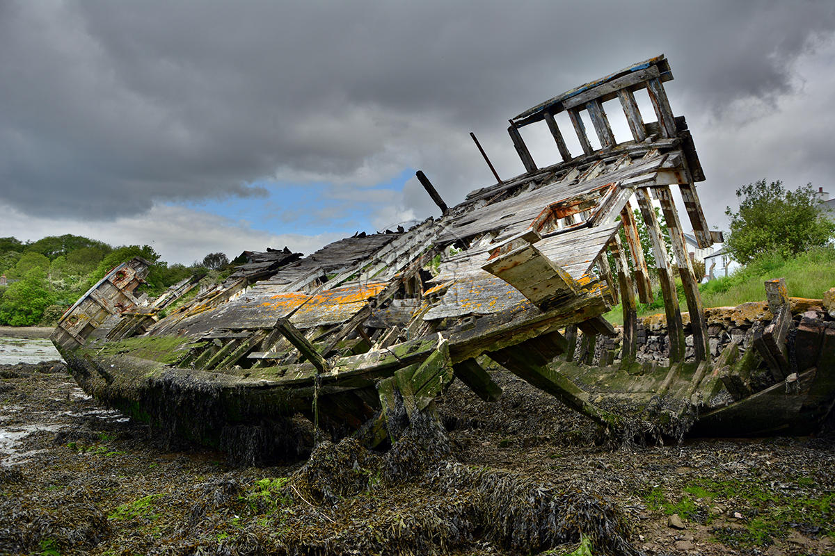
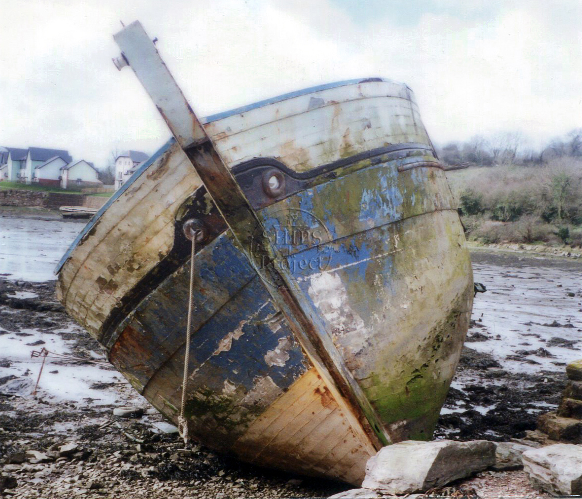
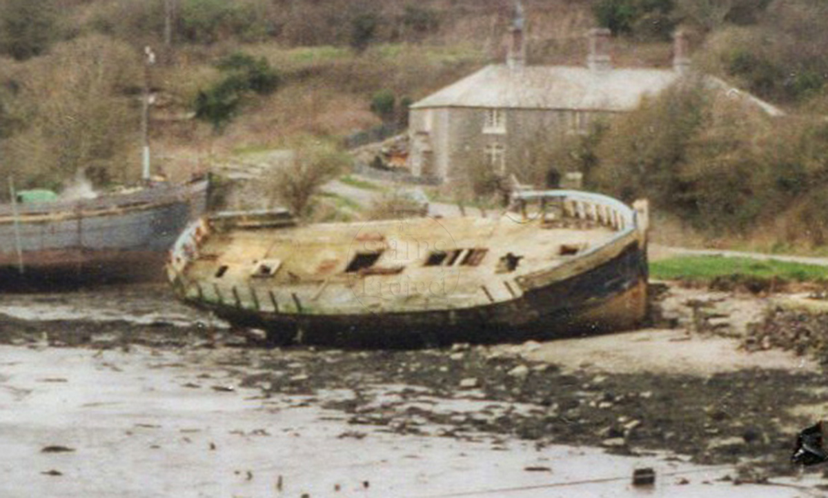
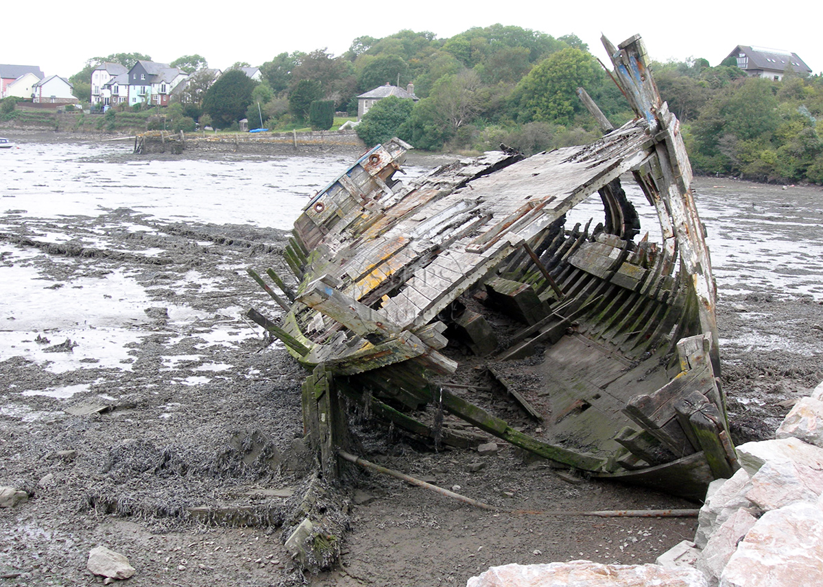
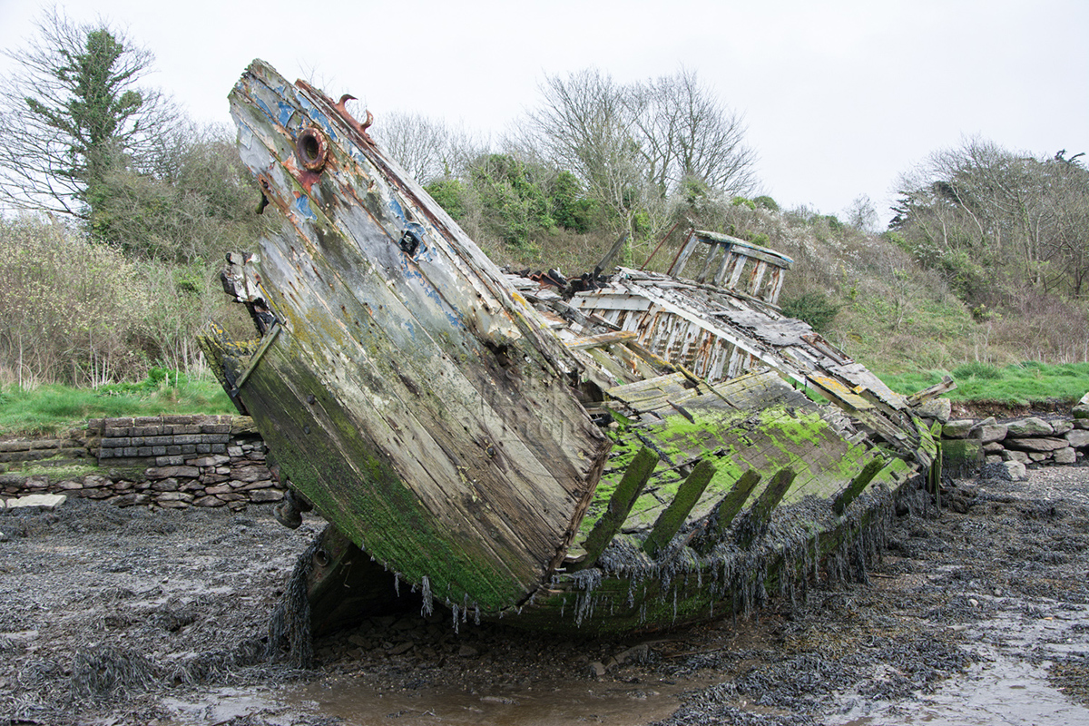
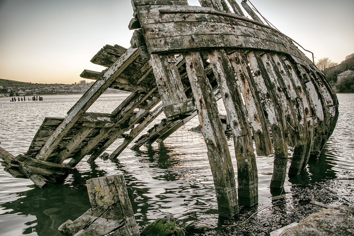
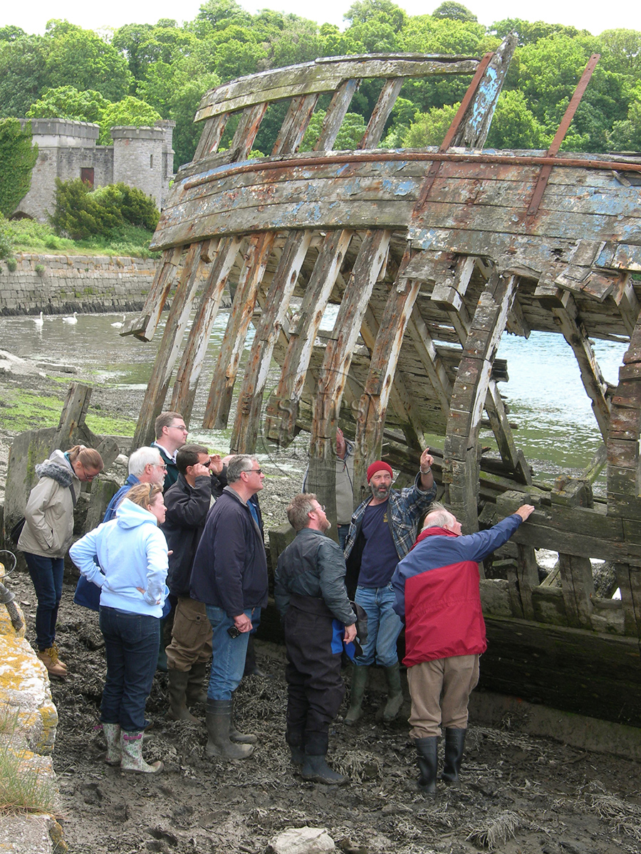
Image use policy
Our images can be used under a CC attribution non-commercial licence (unless stated otherwise).