Not Set
The Roger was a Belgian trawler converted to a houseboat that was laid up under the trees on the southern shore of Hooe Lake, near Oreston in Plymouth.
Type
Belgian Trawler
History
The Roger was built at the Josef Provoost shipyard in Nieuport in Belgium in 1947, one of the last three vessels built there before the yard closed. Roger was built as a motor trawler fitted with a 120hp Blackstone engine for owner August Calcoen, with official number 46364 and fishing under portmark N.814. In 1966, the Roger was sold to a British owner and operated out of the port of Brixham fishing under the portmark BM172. The Roger was de-registered and sold to a Plymouth fisherman in May 1974 and then sold on to a yachtsman who had extra fuel tanks added at Mashfords boatyard on the Cornwall side of the River Tamar. The vessel was sold again and became a houseboat in Hooe Lake. Photographs from this time show that the wheelhouse had been removed and replaced with a shed-like deckhouse and she was painted with a black hull and red above the bulwarks. Roger was occupied up to 1993, but the Roger was later destroyed by fire thought to be started by vandals.
The site has been used for many years by The SHIPS Project as a place to train maritime archaeologists in methods for recording ships both on the foreshore and underwater. The site is also used by 3H Consulting Ltd. ![]() for developing hull recording methods for maritime archaeology and as part of this work a 3D computer model of the remains of the hull have been created. Work has been done on this site in collaboration with Plymouth University BSc Ocean Exploration and MSc Hydrography courses, the University of Bristol MA Maritime Archaeology course and the Nautical Archaeology Society
for developing hull recording methods for maritime archaeology and as part of this work a 3D computer model of the remains of the hull have been created. Work has been done on this site in collaboration with Plymouth University BSc Ocean Exploration and MSc Hydrography courses, the University of Bristol MA Maritime Archaeology course and the Nautical Archaeology Society ![]() . The hull partially fills with sediment brought in by spring tides so this was partially excavated in 2013 so that the shape of the floor timbers could be recorded. The sump under the engine bed was also excavated and recorded and at the bottom was found a Swedish 10 Ore coin, the actual date is obscured but this type is dated from 1952-1962 (SHIPS 13A28).
. The hull partially fills with sediment brought in by spring tides so this was partially excavated in 2013 so that the shape of the floor timbers could be recorded. The sump under the engine bed was also excavated and recorded and at the bottom was found a Swedish 10 Ore coin, the actual date is obscured but this type is dated from 1952-1962 (SHIPS 13A28).
In 2015 the University of Birmingham HIT Team ![]() led by Prof. Robert Stone recorded the remains of the Roger using a DJI Inspire 1 drone to produce a 3D photogrammetric model of the hulk. Video from the drone camera was recorded as it flew around the Roger, and then processed offline using the computer program Pix4D to produce the 3D digital model, see photos 6 and 7.
led by Prof. Robert Stone recorded the remains of the Roger using a DJI Inspire 1 drone to produce a 3D photogrammetric model of the hulk. Video from the drone camera was recorded as it flew around the Roger, and then processed offline using the computer program Pix4D to produce the 3D digital model, see photos 6 and 7.
Description
The remains of the Roger lie in Hooe Lake between high and low water and are covered and uncovered with the tides. The bow of the boat is close in to the shore and the stern lies in the lake when the tide is in. Fire has destroyed the upperworks and deck but but left the keel, lower frames and outer planking with more of the starboard side surviving as the vessel lies on its port side. The counter stern has fallen off and its remains lie in a number of pieces around the stern along with the remains of the rudder. The stem post has broken off and what now remains of the upper part lies on the port side of the hull.
This was one of the vessels recorded in the book Lost Ships of the West Country by Langley & Small.
Sometimes incorrectly spelled 'Rodger'.
Location and Access
Hooe Lake, Oreston, Plymouth
From Oreston, take the Lower Saltram road off Plymstock Road then turn right into Kingfisher Way. Follow the road down to the lake and there is a car park at the end. The remains of the Roger can be seen on the south bank of the lake. Take the footpath heading south under the folly and follow it round to the hulk, there is a gap in the bushes where you can walk through to the beach. Alternatively, walk round via the beach but take care as the rocks are slippery. The wreck partially covers at high tide springs so plan a visit to coincide with low water. The foreshore round the bow of the Roger is firm but the stern lies in mud so appropriate footwear is needed.
Nearby hulks include the lighter Arthur ![]() , unknown vessel Hooe Lake 5
, unknown vessel Hooe Lake 5 ![]() , Dignity
, Dignity ![]() , Acacia
, Acacia ![]() and Hooe Lake 8
and Hooe Lake 8 ![]()
Last updated 18 May 2021


Finds
13A28 Coin ![]()
Information
Date Built:
1947
Type:
Trawler
Builder:
Jozef Provoost of Nieuport, for August Calcoen
Official Number:
46364
Length
18.4m / 60.5ft
Beam
5.3m / 17.4ft
Depth in Hold
2.0m / 6.5ft
Construction
Timber, carvel
Propulsion
Diesel, originally Blackstone 120 hp
Tonnage
27.2 GRT / 34.4 net
Portmarks
N814, BM172
Outcome
Abandoned 1993, later burnt
Reference
Unknown
Hulk Recording Research
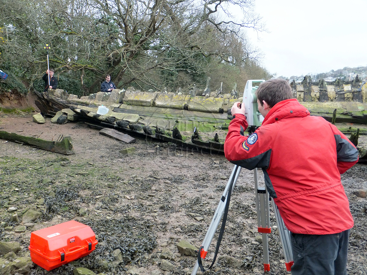
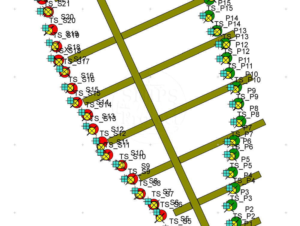
The remains of the Roger are used by The SHIPS Project for researching methods for recording shipwrecks on the foreshore and underwater. For one project in 2013 we worked with Joseph Mortimer on a comparison of survey methods including 3D trilateration using tape measures, total station and RTK GPS. Joe undertook the work with us for his BSc Ocean Exploration with the project titled 'An Assessment of Quality in Foreshore Wreck Survey Methods'.
Not Set
Leave a message
Your email address will not be published.
Click the images for a larger version
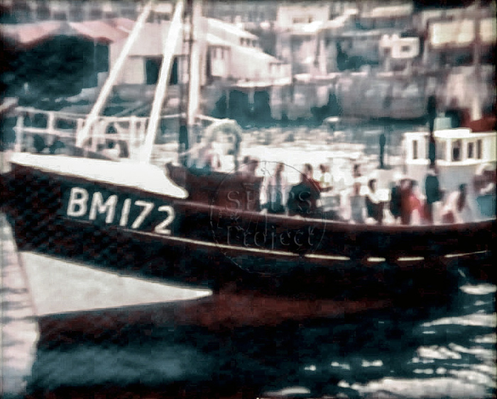
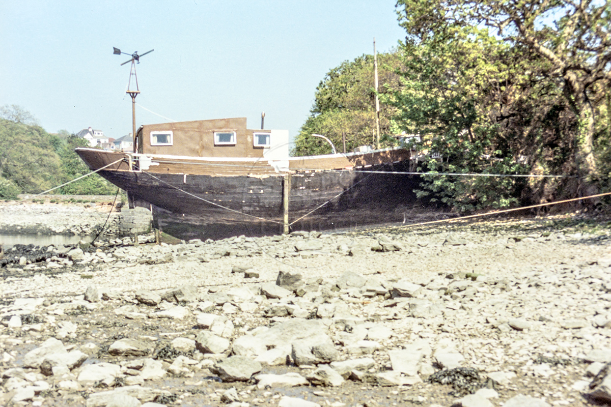
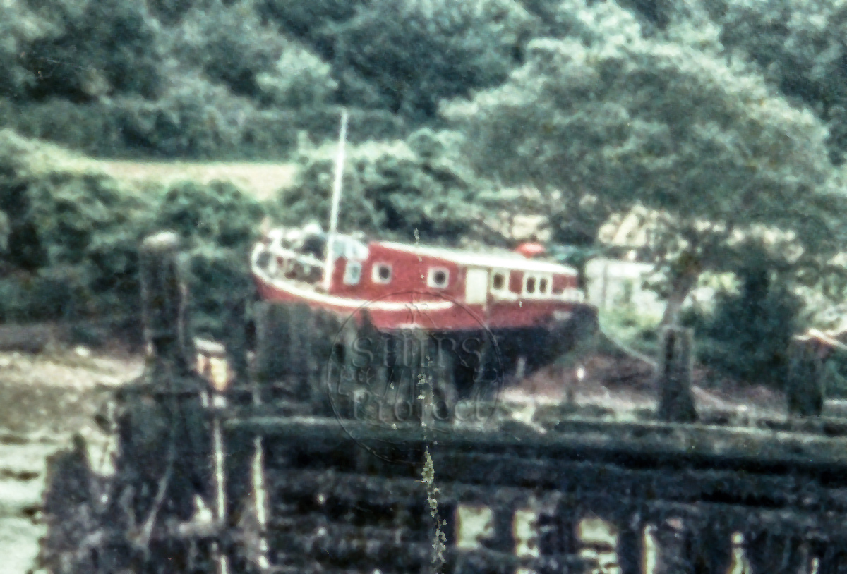
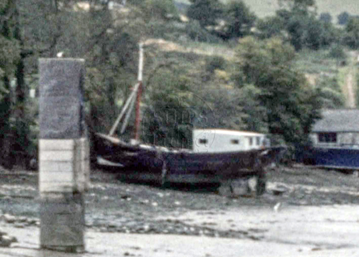
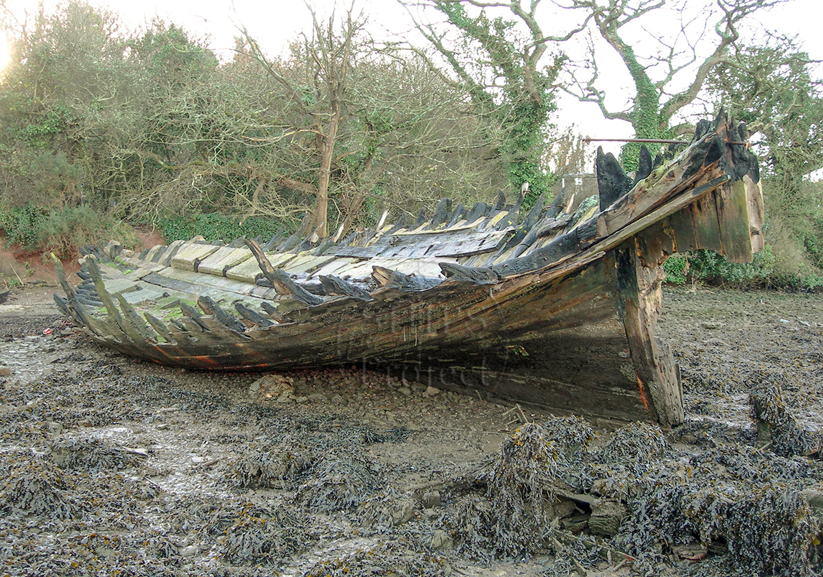
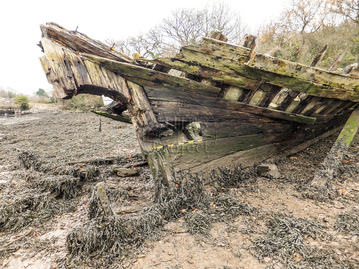
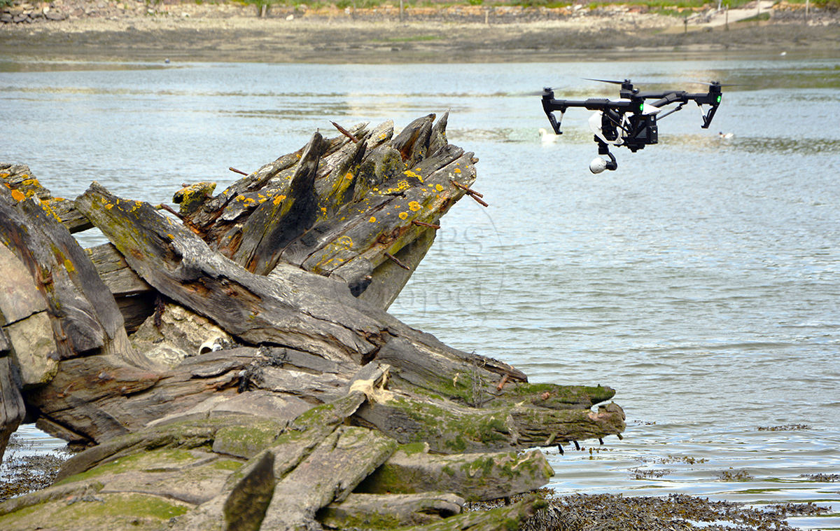
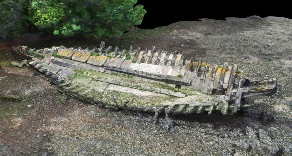
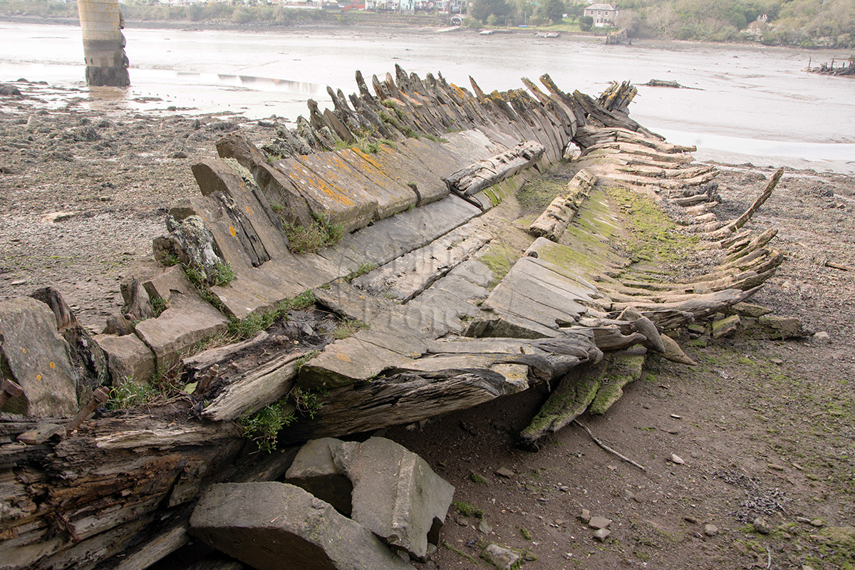
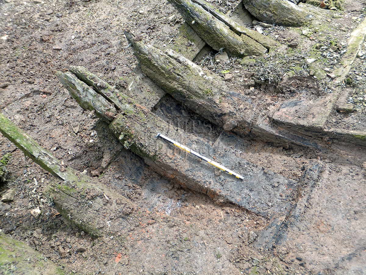
Image use policy
Our images can be used under a CC attribution non-commercial licence (unless stated otherwise).