
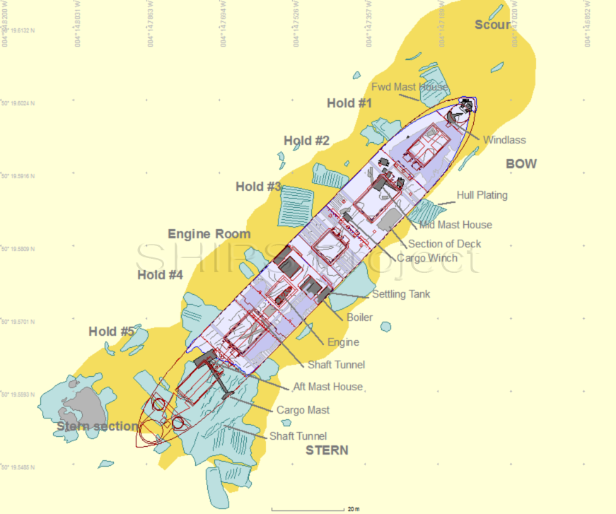
Wreck Site 2: James Eagan Layne Site Plan
The wreck lies with her bow at 50° 19.602 N 004° 14.714 W and the stern at 50° 19.560 N 004° 14.773 W, approximately 1.2 km from the nearest land, 2.1 km north-west of Rame Head and 1.2km north of the Whitsand Bay dumping ground.
The bows are in 20m depth (LAT) and the stern is in 24m. The main part of the hull is 98m long with her bows to the north-east on a heading of 42° true, this section is intact from the bows to the bulkhead between hold #4 and hold #5. The stern section has broken away and lies some 30m away to the south-west.
 James Eagan Layne Site Plan
The detailed digital site plan of the ship is being put together using the Site Recorder software from 3H Consulting Ltd. Using this software, sonar images are combined with digitised hull drawings and detail is added using diver sketches and underwater photographs. The site plan is being developed continuously throughout the project as more information becomes available and as the site itself degrades.
![]() If you can provide more information about this then please contact us.
If you can provide more information about this then please contact us.
